
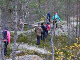
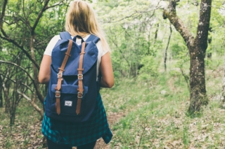
Activities and Nature
Search for interesting activities by type and / or area or with the help of keywords, end by pressing "Show results"
19 Search results, page 1/1
Clear filters-
Cycle routs in the Vaasa Region

Here we present 12 suggestions on cycle routes, that you can choose from when visiting Vaasa. The length of the routes is from 5.3 kilometers to almost 100 kilometers. The shorter routes take you from the center of Vaasa to the city’s surroundings, while the longest ones take you a long way out into the countryside or to the archipelago.
https://www.vaasa.fi/en/see-and-experience/activities-and-nature/bicycle-routs-in-the-vaasa-region/
-
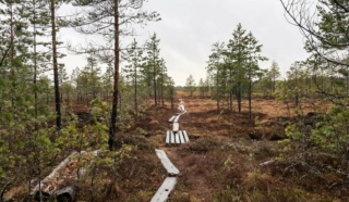
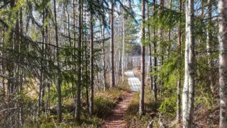
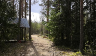
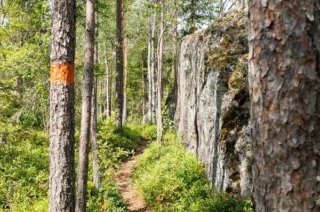
The initial part of the hiking trail on Fatisaari winds through varied terrain until vast bog landscapes unfold before your eyes. Thanks to over a kilometer-long boardwalk, you can admire the marsh landscapes with dry feet. Along this boardwalk, hikers can breathe in the scent of the marsh and take a break at the majestic rock on Fatisaari’s summit, where there is a lean-to shelter. Later, you get to enjoy the beautiful nature once again as you follow the same trail back to the starting point.
- Starting point: From Tulisalontie 525, turn onto Marjoniementie, continue until a narrow road turns right at Tuuralan hunting lodge. The trail is found at the end of this road. Park your car in a way that doesn’t obstruct other road users. Do not park in the hunting lodge yard!
- Length: Approx. 6 km round trip
- Difficulty: Easy
- Walking time: 1.5 to 2 hours
- Map at the web page
- GPX file available here.
https://isokyro.fi/vapaa-aika-ja-matkailu/liikunta/luontoreitit/patikkareitisto/
-
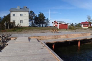
The Gåshällan Nature Station is a renovated former coast guard station located on a rocky island far out in the Närpes archipelago. The nature station is now owned by the Forest Administration and leased by Solrutten.
The island, with its rugged but vibrant outer archipelago nature and its rich plant and bird life, is a place that easily captures your heart.
The unique nature is very sensitive to wear and tear. For many years, birds and humans have been able to live in harmony with each other on Gåshällan, and this should naturally continue. The rich breeding bird fauna limits freedom of movement on the island during the breeding season from May 1 to July 15.
On the northern part of the same island, there is a former pilot station, which today serves as a support point for boaters.
The nature station is suitable for boaters, school camps, companies, private individuals, bird watchers, courses, and other types of groups. We recommend day groups of up to 20-25 people and overnight groups of up to about 15 people, for convenience.
-

The hiking trail begins at the Kajane camping area located along the Kajane forest road, approximately 2.6 km from National Road 8. The Kajane camping area is situated next to a large bog near Lillträsket and Lisansjön. The Kajane hiking trail itself is 3 km long. The trail partly runs on boardwalks across the bog and extends to Lisansjön. Map indicating the hiking trail is marked (pdf).
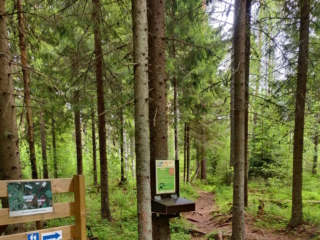
Along the hiking trail, informational signs are placed, providing details about the area’s fauna and flora. The trail leads to Lillträsket (0.8 km) where a shelter is available. At the Kajane camping area, there is also a sauna, overnight cabin, and several barbecue shelters. A fee is charged for the use of the cabin and sauna.
The maintenance of the Kajane hiking trail is overseen by the Yrkesakademin in Österbotten.
For booking the area’s overnight cabin and more information.
-
Starting Point: The parking area is located at the end of Pohjantie.
Length: 1.4 km circular route (total length 2.3 km if taking the round-trip path to Isohaankallio).
Difficulty: Easy.
Walking Time: 30 min – 45 min.
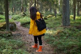
You don’t need to go far to reach Lapinmäki. You can quickly embark on the hiking trail located right next to Isokyrö center. However, don’t let the proximity fool you; along the route, there are genuine nature experiences on an easily navigable trail. The starting point of the route is right next to the playground, making it an excellent destination for families with children.
https://isokyro.fi/vapaa-aika-ja-matkailu/liikunta/luontoreitit/patikkareitisto/
-
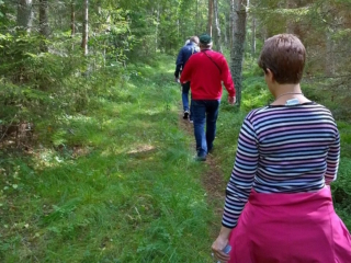
Lymmyysen nature trail is well-suited for families with children. The route offers various types of terrain, and along the way, there is information about different aspects of the area’s nature in the form of signs. It’s pleasant to conclude the excursion in a covered hut or log shelter while enjoying refreshments. The trail is located right next to Palhojaistentie, making it easily accessible.
- Starting point: From the point where Palhojaistentie 260 turns into a gravel road towards the parking area and the starting point of the trail.
- Length: 800m circular route
- Difficulty: Easy
- Walking time: 15 minutes to 30 minutes
- Map on the web page
- GPX-file available here.
https://isokyro.fi/vapaa-aika-ja-matkailu/liikunta/luontoreitit/patikkareitisto/
-
Majors Nature Trail begins at Strandvägen 2118, 6 km south of Pappadagis Neste. There is a large parking area at the beginning of the trail. Along the path, you can walk 1.2 km, 2.2 km, or 3.4 km.
The trail is marked with blue ribbons and informational signs. The shorter trail (1.2 km) with more hilly areas has stairs. There is also a cozy rest area with log tables.
Map indicating the hiking trail is marked (pdf).
-
The trail starts from either Storsjön, Storsjövägen 617, or from Mamrelund, Mamrevägen 357. The trail is a total of 8 km long, or 4 km one way, either to Storsjön or Mamrelund.
The trail between Storsjön in Malax and Mamrelund in Petalax has long been a connecting route between the forest villages in Malax. The trail is marked with orange reflective poles and informational signs.
-
Start Point: Åbergintie 64.
Length: 11 km circular route.
Difficulty: Challenging.
Walking Time: 2.5-3 hours.
The Orisberg area has a diverse history, influenced by many key figures in Finnish history, from Zacharias Topelius to Jean Sibelius. The atmosphere around Orisberg Church is charming, and the starting point for the route is the bell tower, where, according to the tale, Sibelius and Aino Järnfelt got engaged. The route winds around Kotilampi through varied terrain on trails, duckboards, and forest roads. Those planning a shorter excursion can follow the hiking trail to Kotilampi cabin and return along the same path to the church. Those taking on the longer route continue from the cabin, circumnavigating the entirety of Kotilampi.
https://isokyro.fi/vapaa-aika-ja-matkailu/liikunta/luontoreitit/patikkareitisto/
-
Starting Point: The parking area is located next to Peippoos Disc Golf Course, along Peippoostentie just to the left shortly after the playground.
Length: Several circular routes ranging from 1 km to 3 km.
Difficulty: Easy.
Walking Time: Approximately 45 minutes for the 3 km route.
Adjacent to the parking lot is the gravel-covered Kylkkälä Fitness Trail, which is groomed in winter. Walking on the ski tracks is not allowed. There is also a disc golf course along with the fitness trail, so exercise caution regarding flying discs. The starting point of the nature trails is on the opposite side of Peippoostentie. The first 200 meters follow the pedestrian path uphill to the beginning of the trail, and the return point of the route is near the parking area. The nature trail is intended to be walked clockwise. The routes offer a true nature experience right in the vicinity of residential areas. The trail network is diverse, providing plenty of options for hikers. Along the nature trail, you’ll find a fireplace, and next to the fitness trail, there is also a lean-to shelter.
https://isokyro.fi/vapaa-aika-ja-matkailu/liikunta/luontoreitit/patikkareitisto/
-
The nature trail starts fråm Klockarisvägen 14, close to the cross roads with Klockarisgränd.
The nature trail is divided into three parts, and you can walk different distances: 1.8 km, 3.1 km, 3.4 km, and 4.5 km.
-
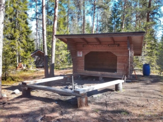
In the area, there are hiking trails and lean-tos, as well as an approximately 8-meter high observation tower with stunning views. Firewood is delivered to the lean-tos a few times a year. During the winter, there are also unlit ski trails in the area. The Rajavuori hiking trail is approximately 5.5 km long, forming a circular route. The trail starts from the wilderness and hiking center.
From Rajavuori, there is a connection to Levälampi, a recreational area maintained by Metsähallitus on the border of Kurikka and Laihia. Levälampi is also connected to Jurva’s Pässilä and further to Kalajaisjärvi in Ilmajoki. The route is known as the “Kurjenkierros,” and the journey from Rajavuori to Kalajaisjärvi covers a distance of 30 km.”
https://laihia.fi/hyvinvointi-ja-vapaa-aika/liikunta/liikuntatilat-ja-alueet/ulkoliikuntapaikat/
-
The Rööki trail combines many different elements. At the starting point, there is a well-equipped beach at Ruusupuro, from where the trail goes through a majestic forest. The diverse natural elements in the area provide variation and challenges for the trail. Near the Rööki lean-to, bird boxes have been installed along the trail, so at the midpoint of the trail, you can sit by the fire and observe the life of birds up close.
- Starting point: Ruusupurontie 769.
- Length: 5 km circular route
- Difficulty: Challenging
- Walking time: 1.5 to 2 hours
- Map and GPX file can be found on the website.
https://isokyro.fi/vapaa-aika-ja-matkailu/liikunta/luontoreitit/patikkareitisto/
-
A European pilgrimage route through coastal Ostrobothnia. Connects up with the Norwegian-Swedish route St. Olavsleden, which leads to Trondheim. A total of 500 km long when complete.
-
Starting Point: Ventäläntie 670, parking only in the designated parking area, do not block the beginning of the trail with your car.
Length: 4 km circular route.
Difficulty: Moderate.
Walking Time: Approximately 1 hour.
The Tuomaanmäki area is a nature reserve that includes a Bronze Age burial mound. The mounds have been excavated, and stones have been removed. From one of them, apparently, all stones have been taken, leaving only a circular arrangement of stones locally referred to as “käräjäkivet” or judge’s circle. This is the origin of the place’s former name, Tuomarmäki. Tuomaanmäki is an environmentally and geographically splendid Bronze Age burial mound site with significant natural values. Along the route, hikers have the opportunity to explore ancient burial mounds, a “giant’s kettle” (which is not actually a giant’s kettle), diverse nature, and take a break at a campfire site. One of the stories from the mobile game “Tarinapolku” can be found here.
https://isokyro.fi/vapaa-aika-ja-matkailu/liikunta/luontoreitit/patikkareitisto/
-
In Vuoressalo, the hiker can ascend from the fields to the top of the majestic white cliffs amidst nature. The cliffs conceal much to see and experience in their shadows. In Vuoressalo, there are many peculiar rock formations, the origins of which have been the subject of speculation over the years. On the current basic map of the area, for example, there is a location called “pakouuni,” a place that, according to legend, is a low, built wall that the farmers participating in the club wars of the 16th century constructed as protection. At the site, there is a natural crack in the rock that forms an approximately 2-meter-high vault. The area is marked by superstition, and these places have not been daringly investigated thoroughly by the locals.
- Starting point: Kuivilantie 174. Parking is available on the opposite side of the road from the starting point. Do not park on the road.
- Length: Two approximately 2 km circular routes
- Difficulty: Easy
- Walking time: 45 minutes to 1 hour
- Map and GPX file are available on the website.
https://isokyro.fi/vapaa-aika-ja-matkailu/liikunta/luontoreitit/patikkareitisto/
-
In the coming years, Vähäkyrö will create, based on the hiking trail development plan 2021, five hiking trail networks:
- Hiking trail network from Kruutari to Mestoosplassi
- Ojaniemi-Hyyriä trail network
- Saarenpää-Mullolan Polkureitti Trail
- Korkiavuoren Luontopolut Nature Trails
- Petulian Patikka Trail
- Map application (in Finish)
In addition, four thematic trails are under development:
- Viiden Sillan Polkureitti Kyrönjoen Varrella (transl. Five bridges along the Kyrönjoki riverbanks Trail) (published in the trail app, to be further developed in 2023)
- Vähäkyrö Children’s Hiking Trail (to be linked to the Ojaniemi-Hyyriä trail)
- Kolkin Patikkapolku hiking trail (this area is listed as a built cultural heritage site of national significance)
- Kirkkosaaren Historiapolku history-themed trail (Kirkkosaari and Kirkkosaari pond, Kaavontönkkä and Vähäkyrö church precinct that are also a built cultural heritage site of national significance)
-
Starting Point: The trails can be accessed from two different points, either from the parking area of Ylipää Youth Association (Ylipään nuorisoseura) at Valtaalantie 403 or next to Lukkuhaan camping area at Kortesluomantie 157. Parking is only allowed in designated parking areas.
Length: Several circular routes ranging from 1-5 km.
Difficulty: Easy, with varying elevations.
Walking Time: Approximately 1 hour for a 5 km route.
Ylipää’s diverse trails offer something for everyone. The area features versatile fitness trails of different lengths and several campfire sites. In the middle of the route, near Marjamäki observation tower, it is possible to take a break with a larger group, as there are two campfire sites there. The trail network is centrally located and easily accessible. The proximity of the camping area makes the trail a suitable destination for visitors to the area, approaching the route through forested landscapes up to the top of Marjamäki.
https://isokyro.fi/vapaa-aika-ja-matkailu/liikunta/luontoreitit/patikkareitisto/
-
The hiking trail starts from Mobergsvägen 520 or Åminnevägen 251. There is no parking available at the start of Mobergsvägen, so it is recommended to park at the Kvarken Boat Museum, where there is also a bird observation tower and a barbecue area. From there, you can access the Åminne hiking trail along Åminnevägen and Mobergsvägen. Alternatively, you can park at Åminnevägen 251 (“Dimmornas bro”), where there is also a barbecue area.
The various stretches of the hiking trail are 2 km, 4.1 km, and 5.1 km, and the terrain is easy, suitable for all. Map indicating the hiking trail is marked (pdf).